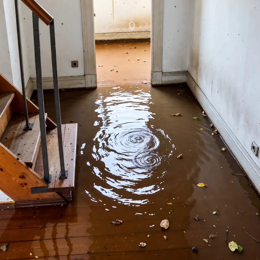
Fountain grew up at the meeting of Jimmy Camp Creek and Fountain Creek, and both creeks have a record of rising. The City's own plan says the 1999 flooding along them showed that the FEMA floodplain maps were outdated, and in April 2020 erosion from historic water levels closed part of Southmoor Drive. When creek water reaches a building, the work is storm and flash flood cleanup, and it starts with understanding what that water carries.
Key takeaways
- Fountain Creek flows south through Fountain, Jimmy Camp Creek meets it, and both creeks flooded in May 1999.
- The City's plan says that flooding showed many residents the FEMA floodplain maps were outdated, and El Paso County's flood map is dated December 7, 2018.
- In April 2020, erosion from historic water levels along Fountain Creek closed part of Southmoor Drive north of Carson Boulevard.
- Creek water inside a building is Category 3 water, so porous materials come out and the structure is dried.
- Flood damage usually needs a separate flood policy, so the policy wording matters before the next storm.
Two creeks that shaped Fountain
Fountain Creek flows south through Fountain. The city traces its roots to the Ute wintering grounds at the confluence of Jimmy Camp Creek and Fountain Creek, so water has been part of the place from the start.
Other creeks have flooded here too. In June 1965, Sand, Squirrel and Fountain creeks overflowed while 2 to 3 inches of hail fell in the Security and Fountain areas.
The flood record the City points to
Three dated events frame what creek water has done in and around Fountain.
- June 1965: Sand, Squirrel and Fountain creeks overflowed during a regional storm that also dropped 2 to 3 inches of hail in the Security and Fountain areas.
- May 1999: Fountain Creek and Jimmy Camp Creek both flooded, and a national disaster was declared for flooding in El Paso County that month.
- April 2020: extreme erosion from historic water levels along Fountain Creek closed a section of Southmoor Drive north of Carson Boulevard, with the creek within a few feet of the road.
What the City concluded
The City's comprehensive plan says the FEMA floodplain maps were outdated, which became apparent to many Fountain residents after the 1999 flooding along both creeks.
Erosion can close a road long before water reaches a house, so April 2020 is a reminder that a creek in flood can do damage without ever entering a building.
What the City's plan and the maps say
The City's plan sets a policy to prohibit development within the 100 year flood plain of Fountain Creek and Jimmy Camp Creek. El Paso County's FEMA flood insurance rate map is dated December 7, 2018.
The Pikes Peak Regional Building Department handles permitting and inspection for the City of Fountain and enforces floodplain regulations. Where repairs after a flood need a permit, that department is the place to ask.
A map date is not a promise about any one street, and the City itself says the earlier maps proved outdated. FEMA's flood map service center lets anyone search a map by address, and the building department can answer floodplain questions.
What creek water does inside a building
Creek water carries silt, debris and whatever the runoff picked up on the way. Fountain Sanitation District says flood waters contain bacteria and other hazardous microorganisms, so the water is treated as Category 3 from the moment it is inside.
That drives the cleanup. Mud is shoveled and squeegeed out first, then the water is pumped, and porous materials such as carpet, pad, wet drywall and insulation are removed.
Hard surfaces and framing are cleaned and treated with an EPA registered antimicrobial. Structural drying follows, using air movers and LGR dehumidifiers until readings match a dry reference, without added heat in closed interiors, which the district advises against.
- Silt and mud: removed before drying equipment is set.
- Standing water: extracted with pumps and wands.
- Porous materials that touched the water: cut out and bagged.
- Hard surfaces and framing: cleaned, treated and dried.
- Documentation: moisture readings and photographs for the claim.
Why speed matters
Fountain Sanitation District says successful restoration depends largely on how fast the building and belongings are dried. Mold can begin to grow in wet drywall and insulation within 24 to 48 hours, so extraction and drying start as soon as the area is safe.
First steps when creek water enters
Safety decides the first steps, and water extraction in Fountain follows once the area is safe.
- Keep clear of moving water, and avoid flooded roads altogether.
- Power stays off in wet rooms until an electrician has tested the outlets and the panel.
- Photograph the high water mark on the walls before any cleanup.
- Move belongings upward and out of the water's reach, if that can be done safely.
- Children and pets stay out of the affected rooms.
- Call the insurer and a water damage restoration team in Fountain, and write down who was called and when.
Belongings after flood water
Flood water decides what can be kept. Anything porous that sat in it soaks up the contamination, while hard items can usually be cleaned.
- Usually discarded: mattresses, upholstered furniture, carpet, stuffed items and food that touched flood water.
- Often cleaned and kept: solid wood, metal, glass and plastic items, after cleaning and treatment.
- Photograph first: record each item before it is discarded, since the insurer may ask for proof.
- Papers and photographs: separate them and dry them flat, or ask a restoration team about specialty drying.
Flood insurance and checking risk before the next storm
Flood damage is usually excluded from a standard homeowners policy and covered by a separate flood policy, and a new flood policy often has a waiting period before it takes effect. The time to ask is before the creeks rise.
Photographs of each room, a list of belongings and the drying logs are what a claim file is built from.
- Is flood covered under the current policy, and what is the limit?
- Does the policy cover sewer or water backup separately?
- What records does the insurer want before cleanup starts?
- How does the insurer want emergency steps documented?
Questions
Which creeks affect Fountain?
Fountain Creek flows south through Fountain, and Jimmy Camp Creek meets it at the confluence where the city traces its roots. Sand Creek and Squirrel Creek overflowed in the June 1965 storm.
What does the City say about the flood maps?
The City's plan says the 1999 flooding showed many residents that the FEMA floodplain maps were outdated. El Paso County's FEMA flood insurance rate map is dated December 7, 2018.
Is creek water in a house Category 3?
Yes. Flood water carries soil, sewage and runoff, and Fountain Sanitation District says flood waters contain bacteria and other hazardous microorganisms. Porous materials it touched are removed.
Does homeowners insurance cover creek flooding?
Flood damage is usually excluded from a standard homeowners policy and covered by a separate flood policy. Check the policy wording and ask the insurer.
Where can the flood zone of an address be checked?
FEMA's flood map service center lets anyone search a map by address, and the Pikes Peak Regional Building Department, which enforces floodplain regulations for Fountain, can answer floodplain questions.